Saturday, July 27, 2013

Bitterroot Valley, Montana

Up and over the pass from the Sawtooths -- and there were the Bitterroot Mountains!  Another long, lovely valley with a variety of small ranches and towns.  We spent one night in a campground near a natural hot springs (and did we enjoy a nice soak) and then moved on up the valley.

We found a delightful campground at Lake Como.  The Lake was named by an Italian priest in the 1880s (?) in memory of Lake Como in his homeland.  It was quite hot during our stay (high 90s) and so we were a bit low key:  walked around the Lake one day (maybe 8 miles) and sat along the Bitterroot River another.  The Bitterroot is famous for its fly fishing and we watched several boats trying their luck.

Blodgett Canyon is one of the 11 east-west canyons that line the western edge of the Bitterroot Valley.  We opted to try a backpacking trip up the "Yosemite" of the Bitterroots.  The canyon walls soar thousands of feet high from the valley/creek floor.  It was quite lovely.  We walked about 7 miles in and spent 2 nights.  We had expected to find the trail near the creek and have plenty of time to play in the cool waters.  Wrong.  The trail was not near the creek and anyway the FLIES and MOSQUITOS were fierce.  So apart from the time walking -- we read and played cards in the tent.  OH WELL.

Then on to Missoula and then up towards Glacier.  Our itinerary from here on depends on the weather and .... forest fires.

Lake Como in the Bitterroots

View down Blodgett Canyon, the Yosemite of the Bitterroots

Checking out the peaks!

Hiking hazard--thimbleberries were ripe at lower elevations.  Makes for slow, but delicious, going.

Blodgett Creek

Mostly a lovely trail; not near the creek (oh well)

The tent -- our haven from the BUGS

Walking out under the moon!

Monday, July 22, 2013

Sawtooth National Recreation Area -- An Outdoor Paradise

We relished our 2 nights in an Idaho Falls Motel.  Especially since outside the thunderstorms and rain lasted throughout the night!  Our hotel had pool, hot tub, breakfast, and hot showers.  What was not to love??

But, it was time to move on and we decided to head towards Ketchum/Sun Valley and then go up into the Sawtooth National Recreation Area.  We didn't know much about the area, but the campground book listed many possibilities.

We stopped at the Information Station and picked up a trail map that included a few facts about the Sawtooth NRA.  The Sawtooth National Forest is 2.1 million acres; within the Forest the National Recreation Area is a mere 756,000 acres; the Wilderness Area a smaller subset of both:  217,000 acres.

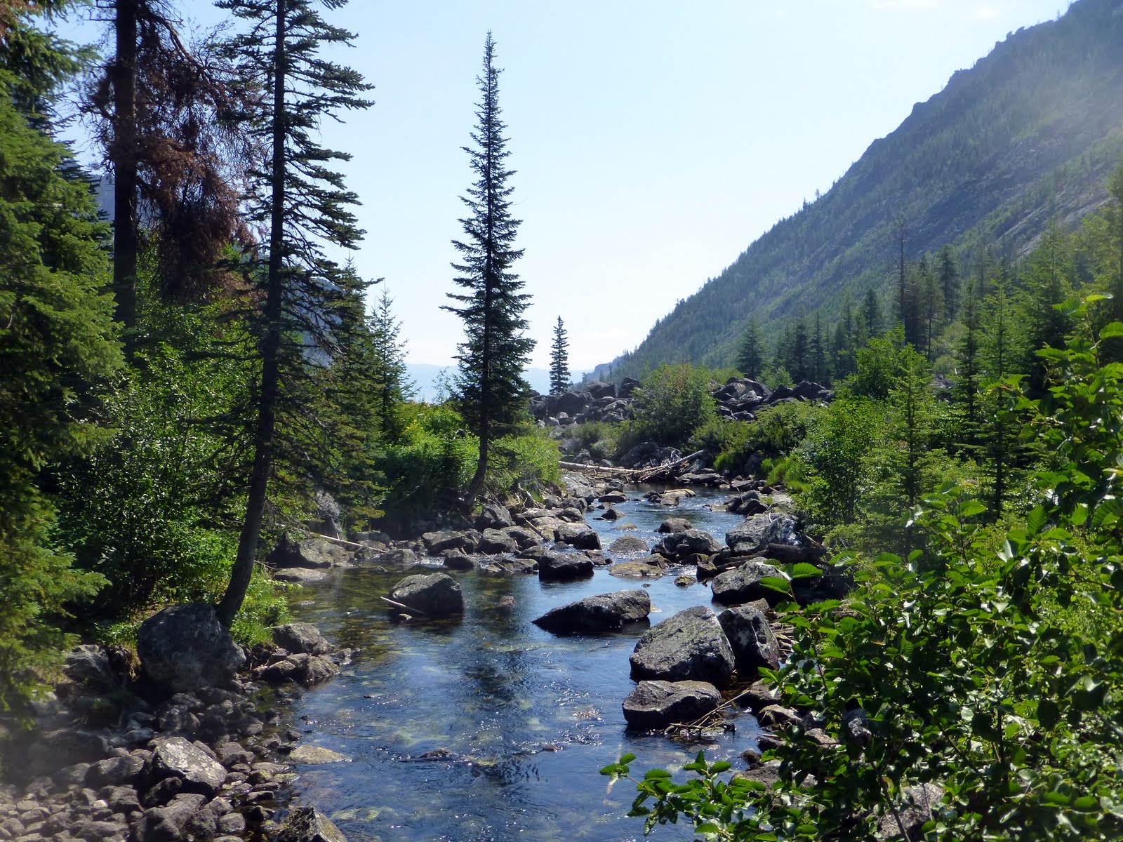
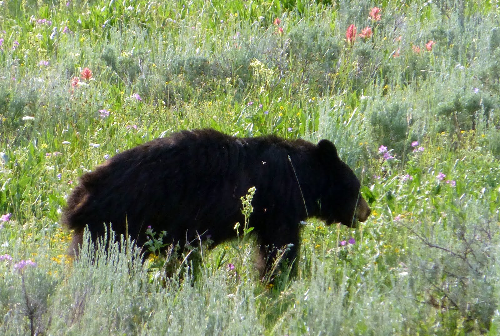
The Sawtooth NRA features the convergence of 4 mountain ranges (Sawtooths, Boulders, White Clouds, and Smokys) in a location known as The Cross.  The ranges combine for 40 peaks over 10,000 feet.  1,000 lakes including 300 high mountain lakes beckon hikers.  The headwaters of Idaho's 4 major rivers are here:  Salmon, Payette, Boise, and Big Wood add up to 1,000 miles of stream and river in the NRA.  It seemed that everyone had either a boat, kayak, or a fishing pole at the ready!

Clearly the Sawtooth NRA is the heart of Idaho's majestic outdoor lifestyle.

We arrived and grabbed a tent site on Alturas Lake.  We hiked to Hell Roaring Lake.  We hiked to Titus Lake.  We had coffee by the Lake.  We drove to a few other Lakes (Pettit and Redfish).  We watched the sun arc across the sky and leave the White Cloud Peaks bathed in soft light.  We are making plans to come back here!

(OOPs.  The scourge of the west -- forest fires -- filled the sky with smoke at times.   The fire was miles away; no danger to us.  But it is hot and dry and beetle kill trees are everywhere.)

Name that Lily?

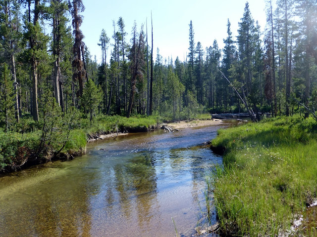
Hell Roaring Creek at a moment of calm & quiet

Titus Lake

Hell Roaring Lake and the Finger of Fate looming above

The Boulder Mountains

Tuesday, July 16, 2013

Wildflowers in the Tetons

I just can't stop taking these pictures.  I don't know too many names...but I figure when I'm back on the boat I will have all the time in the world to figure out what the heck they are!

Believe me--I have more flower pictures than view shots!!

A lovely butterfly & flower at Avalanche Divide.  Rocky ground.

Flower...

Indian Paintbrush..the state flower of Wyoming comes in so many colors!

Fun shape

Pink dabs in a green meadow

columbine

Columbine

A busy bumble bee

Tiny blossom

Flowery bottle scrubber...

Backpacking in the Grand Tetons


The Grand Tetons beckoned us...let's lose the crowd and really see the backcountry.  Of course, we overlooked the detail that the backcountry is really the HIGH country...as in up you go!

We picked out a 3 day, 2 day trip that started off with the boat ride across Jenny Lake (elevation 6780 feet) and then a mile of switchbacks up to Inspiration Point (elevation 7200 feet).  From there we slowly meandered up the  Cascade Canyon, past Valhalla Canyon, always with the sound of rushing water in the background.  (This is the quintessential Grand Teton hike and so we had lots of company on the trail.)

At the Forks (elevation 7800) we turned south.  And really started the climb.  It is hard to describe the hike -- exquisite trees, steep canyon walls, snow packs, a bear on the trail (we scrambled down into the meadow while banging our poles), rushing & gurgling water.  The South Fork Canyon has several hardened campsites and we found one in the early afternoon--pitched the tent and flopped down exhausted.  It was all we could do to beat off the mosquitos that are as big as all Wyoming!

The next day we left our site and did a day hike further up the South Fork Canyon.  The sky was so blue; the water sound so loud, melting snow, lush meadows.  And the trail kept climbing.  Our decision point:  do we go to Hurricane Pass or Avalanche Divide?  I'm not sure what the theme of natural disasters is here -- but we opted for Avalanche Divide.  The trail was supposedly a bit longer, a bit higher, and led back into the heart of the Tetons.  Sure.  And I wanted to hike on snow.

UP UP UP.  Avalanche Divide trail ends at the top -- 10,680 feet!  With views of the snow covered Wind River Mountains to the east and the plains in Idaho (through Hurricane Gap) to the west.  And glaciers and the Teton Peaks and hidden alpine lakes.  Oh, it was so beautiful and so welcome a reward.

Then back down to the campsite for another night swatting bugs.  Out the Canyon today.
The trip so exceeded our expectations!!
Off to Idaho Falls.  A shower!

Jenny Lake in the background...the fun begins

Packing Heat -- they really push carrying bear spray on hikes and a ranger loaned Alan a can.  We did point it at the black bear along the trail.  But he was SO NOT interested in us!  Thank goodness!

Avalanche Divide.  Kit and Snowdrift Lake -- they feed Avalanche Creek and then Taggart Lake.  
View of Backsides of the Grand Tetons.
View across to Hurricane Pass and over Schoolroom Glacier
Waterfalls and Rocks and Trees.  Run the faucet in the background for full effect.

The Wall (see Alan?)


Grand Tetons: One of our New Favorite Places

South, yet a world away, we settled into Grand Teton National Park.  We are always a bit loose on how long; where next; what should we do.  And the Tetons offered us so many choices.  That we stayed and then stayed a bit longer.  And we still have things to do.

The Tetons have something for everyone:  hiking, nature study, canoeing, white water rafting, lake cruises, fly fishing, mountaineering, backpacking, cycling, stand up paddleboarding....  And down the road in Jackson Hole -- food, hotels, shopping.  And that is just a start of a list.

So we hiked and hunted down birds for our list (trumpeter swans and calliope hummingbirds) and I snapped pictures of wildflowers blossoming along the trail.  Our canoe trip around Jenny Lake was sprinkled out.  We hiked to Two Oceans Lake; we explored the Laurance S Rockefeller Preserve and Phelps Lake; we celebrated Alan's birthday; we listened to classical music on the Visitor Center Deck and watched the light on the mountains; we watched cyclists spin by on the newly paved 30+ miles of bike paths in the town and to Jackson; and we just relaxed.

Too bad the season is short here and winters, well, are brutal.

The Tetons and Jackson Lake.  No pesky foothills to mar the view!  

The Tetons reflected in the Snake River....oh so lovely

The Visitor Center at the LSRockefeller Preserve honors the Rockefellers special relationship with the Grand Tetons and other National Parks.  An amazing "green" building.

Wednesday, July 10, 2013

Yellowstone National Park

Yellowstone.  First and Best, so the signs might say.  Definitely huge, challenging, and chock a block full of sites and sounds.  Oh yeah, and weather.  Rain, wind, hail.  Oh yeah.

No luck looking for the wolf pack; but all the other large mammals out in force.
Thermal features as engaging and entertaining as always.
Backcountry lakes, waterfalls, wild and scenic rivers, serene hikes, wildflowers and birds.

RAIN.   WIND.  HAIL.
Happy to move south to the Tetons.

Lamar Valley in Northeast Yellowstone.  Bison everywhere!

The Yellowstone River

Tower Falls

Breakfast Scramble underway

Found this friend on the trail to the Geyser Basin.  Please -- you first!

Colors, Steam, Bubbling Everything

Colors in the hot water run off

Pool with bobby sox trees (white trunks)

Trumpeter Swans at Grebe lake

Historic Fort Yellowstone...from the early Army days

Grand Prismatic (thanks Alisa on tip for spot for this picture!)

Mystic Falls

Old Faithful.  And our new faithful friend:  black sky about to dump on us hapless tent campers!

Meadow hike to Shoshone Lake -- largest lake in continental US without a road to it!


Cody, Wyoming

Cody surprised us completely!   We expected a small town; maybe a few restaurants; maybe a cowboy or two.  Cody:  small town, a few restaurants, a cowboy or two, AND a world class museum. The town was easy to navigate (one street), everyone was helpful, and we totally enjoyed our stay.

Worth the trip:  5 museums in one and we spent 2 days only doing 4 (quickly!!)

Be grateful now!

Leaving Cody and traveling the Chief Joseph Highway

Metal sculptures revisit the flight of the Nez Pearce Indians

Mountains Mountains Mountains