Rain. The forecasts for a week were for rain all day Sunday. That was fine -- we would find a campground and hunker down for a day of rain.
So when we arrived at our forest service campground the host reminded us -- "we are due for some pretty bad weather."
"Yes, rain all day."
Um.... rain and high winds and maybe a tornado.
TORNADO? This was on Friday morning.
The host talked to us about using the 1920s stone bathrooms as a "shelter in place" site; but yes we could park Bessie down in the parking lot to minimize our concern about falling tree branches.
Saturday morning the forecast seemed about the same. The challenge with being from "someplace else" is you just don't know what it really means and where do you go for anything better/safer. We hiked and then got on line to look for ourselves at the local forecast.
YIKES!!!! When I went to check weather for the little dot of a town 10 miles away a Severe Weather Warning popped up: Rain, 2 inch hail, 60 mph winds, tornado threat. I wasn't exactly sure what all the words meant but I knew enough to get going!
We figured since the most severe weather was in south and east Arkansas we would go north and west towards Beaver Lake (our ultimate Arkansas destination all along.) But we had to laugh as we pulled into Horseshoe Bend Campground on the Beaver Lake. Yes they had plenty of open spots -- everyone else was LEAVING -- due to the weather. Most of those campers were local so I guess being home was better than being in an RV.
Again the camp host talked us through the emergency precautions and we found a spot. And then nothing happened. We had breezy conditions all day Sunday, but until the evening no rain. Then lightening and thunder and a bit of rain. We were so grateful.
And even more thankful when we heard on Monday morning about the devastation near Little Rock -- and all across the south. Now we are visiting friends and the temps are really cold and it is windy. But all is well.
Wednesday, April 30, 2014
Mount Magazine State Park
Mount Magazine -- the tallest peak in Arkansas -- was our next stop along the "explore the best of Arkansas" tour. We found a forest service campground at Cove Lake and scored a spot right on the Lake -- quite lovely for evening and morning relaxing!
Mount Mountain (like many here) is not what I think of as a mountain -- more a large, long, flat plateau. And while it is the tallest in Arkansas, it is only 2,753 feet atop the peak at Signal Hill. The forest here is a mix of hardwoods and a bit of pine. Due to last winter's severe ice storm, there are downed trees and branches EVERYWHERE.
The Park is famous for its multitude of butterflies, hang gliding records for Arkansas (140+ miles!!), and a few lovely birds. We saw ovenbirds, black and white warblers, and the magnolia warbler in brilliant breeding plumage looking like the masked bandit of the forest! Fun.
Oh yeah, and then there is that weather...
 |
| Blue Mountain Lake from Mount Magazine |
 |
| Hard to snap a butterfly! |
 |
| 1 state down and .....NO |
 |
| Note the map of Arkansas |
Thursday, April 24, 2014
Petit Jean State Park
Petit Jean State Park nestled on a mountain bluff south of the Arkansas River, is a legacy of Company V-1781 of the CCC. This "veterans" company was a bit older and had more skills than the typical CCC unit; thus they were able to contribute the specialized construction required to build Arkansas's first state park. The work of this company is preserved in over 80 buildings, structures, trails, and bridges throughout the park.
The Park sits high on the mountain: hardwood forests cling to steep hillsides, bluffs and cliffs rise from the creek floor, dams harness the creeks and create lakes. Thanks to the CCC there are trails down the steep bluffs to creeks flowing below!
We also birded at the Holla Bend National Wildlife Refuge -- just down the road & the mountain from the park. We spotted a bald eagle nest with young; also prothonotary warbler, pileated woodpecker, pectoral sandpiper, and broad tailed hawk. We did not find the varied bunting -- somewhere soon!!
 |
| Colorful Park Sign -- highlights Cedar Creek Falls, the center piece of the Park |
 |
| Bridge built by CCC |
 |
| Cedar Creek Falls -- at 95 foot drop, the highest in Arkansas. Hike is down more than 200 feet cut from rocks by the CCC. |
 |
| One of only a few wildflowers on the trail. |
 |
| Cedar Creek scene |
 |
| CCC Water Tower |
 |
| Carpet Rock -- can you see the "pattern" in the rock? Made when the sandstone rock is crisscrossed with fractures and then filled by quartz. When the sandstone erodes -- quartz patterns remain. |
 |
| Iron and sulfur give the hillsides springs the "yellow orange" color |
 |
| CCC Creek bridge -- really so lovely in the woods |
 |
| Without the CCC -- well, this park would sure be different! |
 |
| Geocaching -- using billion dollar satellites to find ammo containers filled with trinkets! |
 |
| Sandstone Arch |
Sunday, April 20, 2014
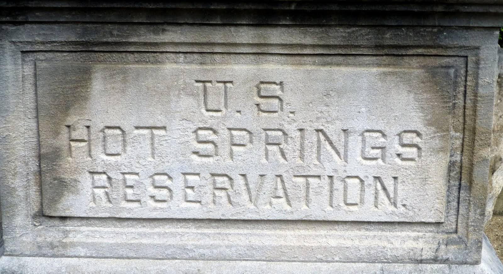
Hot Springs National Park in Arkansas
A whole couple of days and not 1 picture. Pretty drab. Glad to leave Oklahoma!!
And get to Hot Springs National Park. Which is a very interesting & sort of "how not to have a National Park." The Hot Springs were some of the first land ever set aside by the Federal Government -- as early as the 1830s. But...they did not set aside any of the surrounding area, so today there is this incredible mish-mash of commercial business superimposed on the visitor center, etc. Like The Museum of the Gangster, Ginger's Popcorn, and the Vapor Store....um....like trashy.
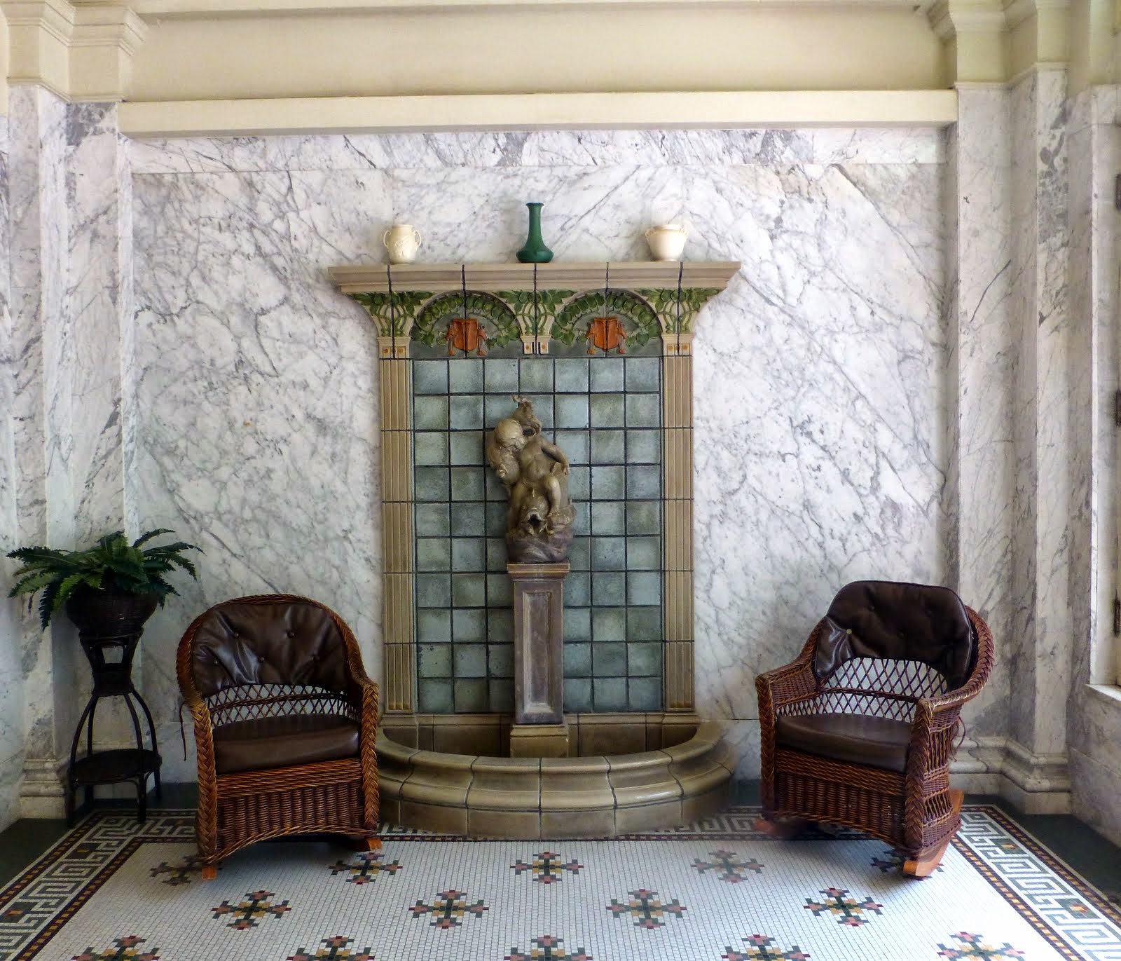
BUT, we did manage to find one of those commercial ventures offering hot mineral springs bath -- oh my, does it make one's skin so soft. No chlorine or other chemicals. Oh it was nice.
And we hiked a bit -- I guess the walks were part of the scene at America's Spa in the 1880s.
We walked a bit of the Baseball Trail -- turns out that spring training was held in the Hot Springs area in the era of Babe Ruth & Cy Young & Honus Wagner. They came to "boil out" the nights of drinking. Honest, that is what the sign said!
We walked the Garven Botanical Gardens. Late for the tulips and other spring flowers. Nice walk.
 |
| America's First Health Plan -- go soak in the Hot Springs!! |
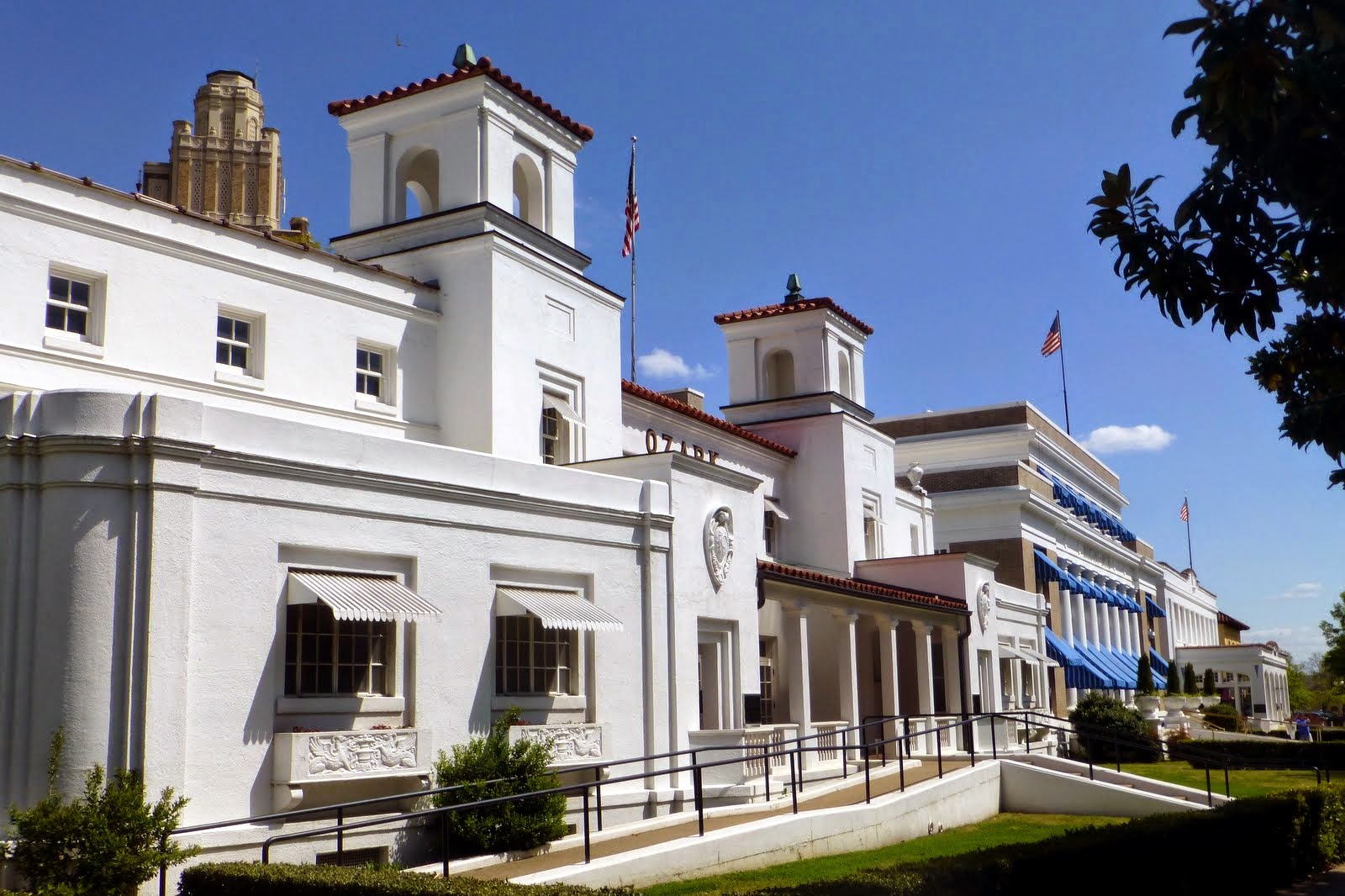 |
| Looking down Bathhouse Row |
 |
| One bathhouse has been restored as the "Visitor Center" |
 |
| Yesteryear's steam room |
 |
| Hot Springs just ooze from the ground |
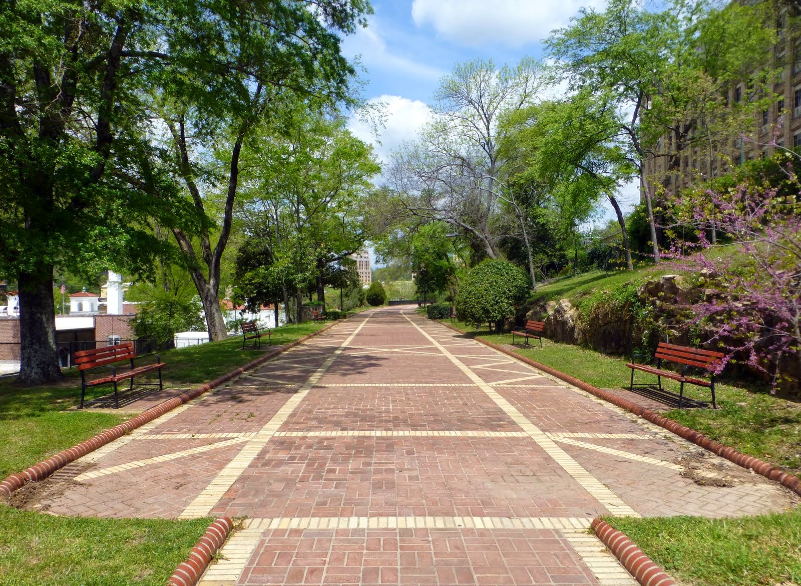 |
| The Formal Promenade on hill above the Bathhouses |
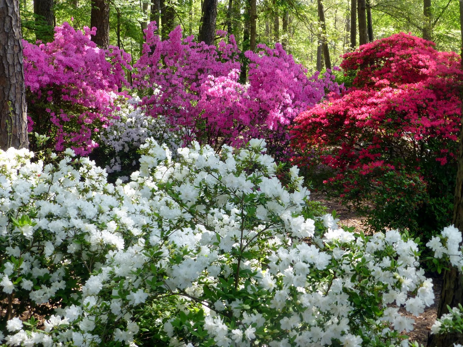 |
| Spring colors at the Gardens |
 |
| View at the Gardens |
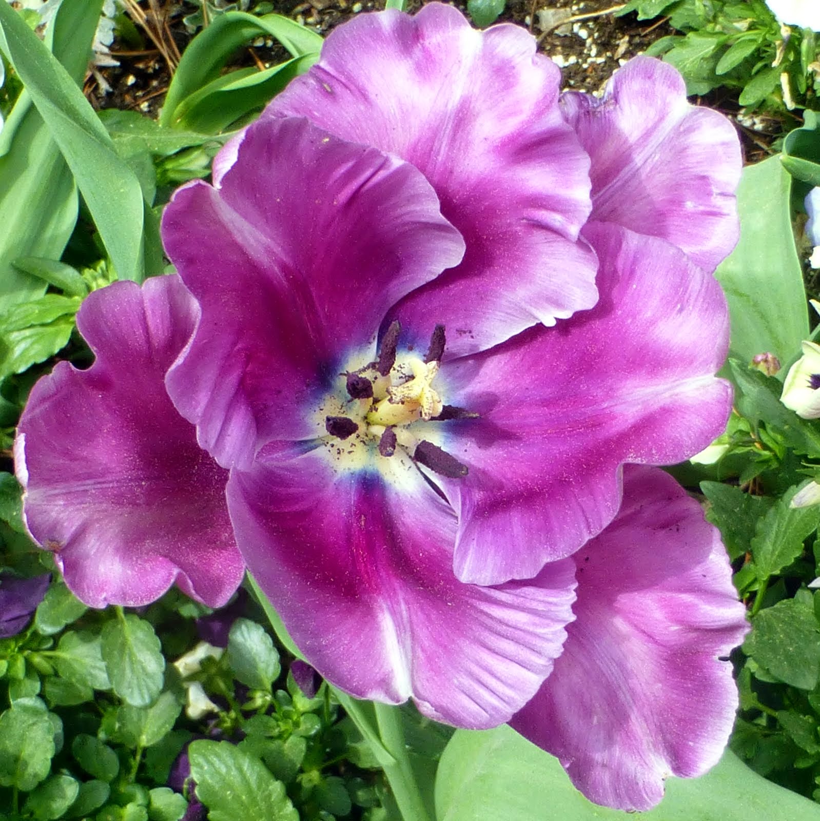 |
| Lovely Bloom |
 |
| Stained Glass ceiling in the lounge area |
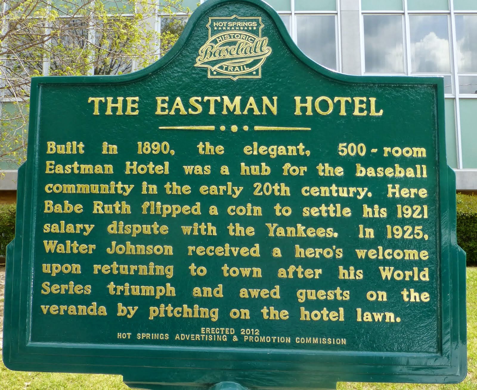 |
| Local connection: Eastman Hotel & Babe Ruth. Reminded Alan of when Frank skipped school and peeked through the fence to see Babe Ruth hit a home run in Seal Stadium in SF about 1920. |
 |
| Detail |
Monday, April 14, 2014
Weather Wimps
Yup, we are weather wimps. Yesterday it was in the 90s and we spent the afternoon sitting in the oak trees so we could bird at sunset. We saw about 40 species, many new to us! Exciting!
This morning. Temps in the 30s. Snow flakes. Tonight's forecast: temps in the 20s. Gotta go.
We were so tough that we moved Bessie (the RV) about 3 campsites over to an electric site. Plug that heater in and let's have breakfast in comfort!
On to eastern Oklahoma tomorrow...
This morning. Temps in the 30s. Snow flakes. Tonight's forecast: temps in the 20s. Gotta go.
We were so tough that we moved Bessie (the RV) about 3 campsites over to an electric site. Plug that heater in and let's have breakfast in comfort!
On to eastern Oklahoma tomorrow...
Saturday, April 12, 2014
Wichita Mountains National Wildlife Refuge
East -- blink that was New Mexico.
East -- blink that was Texas.
East -- um, I guess we are in Oklahoma. Um.
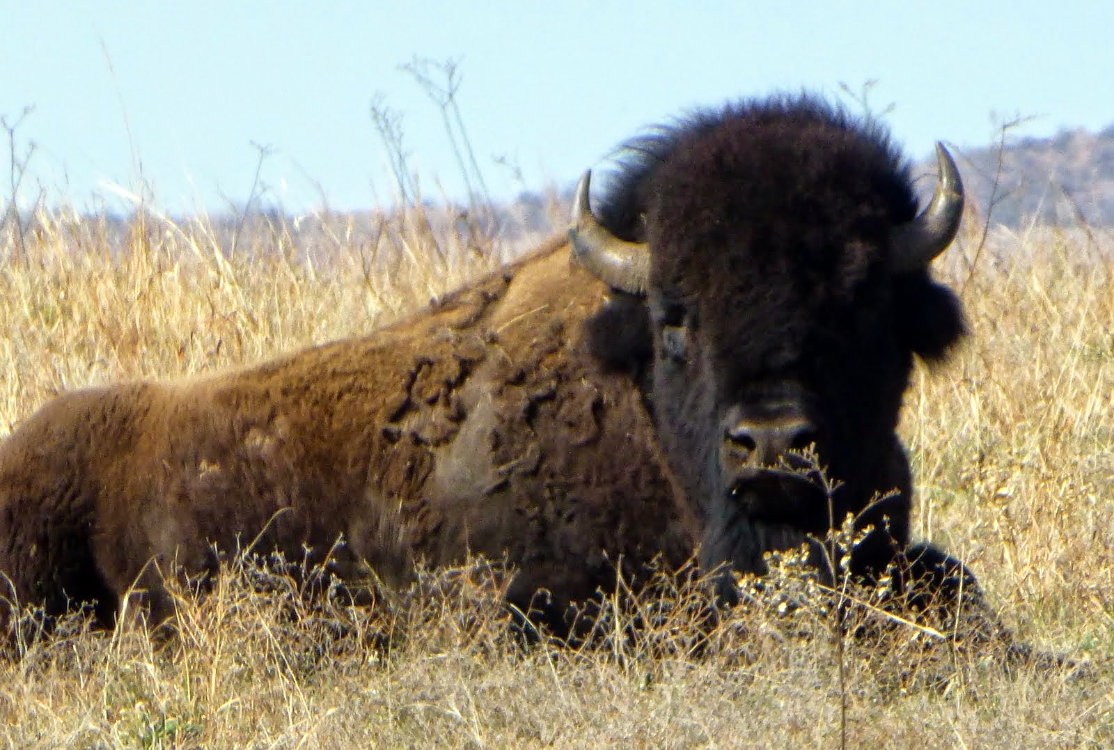
Our destination was the Wichita Mountains Wildlife Refuge -- a truly unique spot among the nation's wildlife refuges. Established in 1901 as a Forest Reserve, the purpose was to set aside "the mountains" from the area being opened for settlement in a land auction. In 1905, the area was re-designated as a Forest and Game Preserve--and the game of the day: bison!
Like in OOPS -- the bison is about extinct, so let's move a few from the Bronx Zoo (to great hooplah) and see if bison can live in a controlled "wild" setting. It worked and today the herd is maintained at about 650 head. Bison are culled each year and auctioned.
Well, once the bison were established it was decided to try bringing back the elk. The first elk were brought in from the Jackson Hole area, apparently the local elk were truly extinct. The herd here now is about 700 strong. Elk are hunted via a special lottery each year.
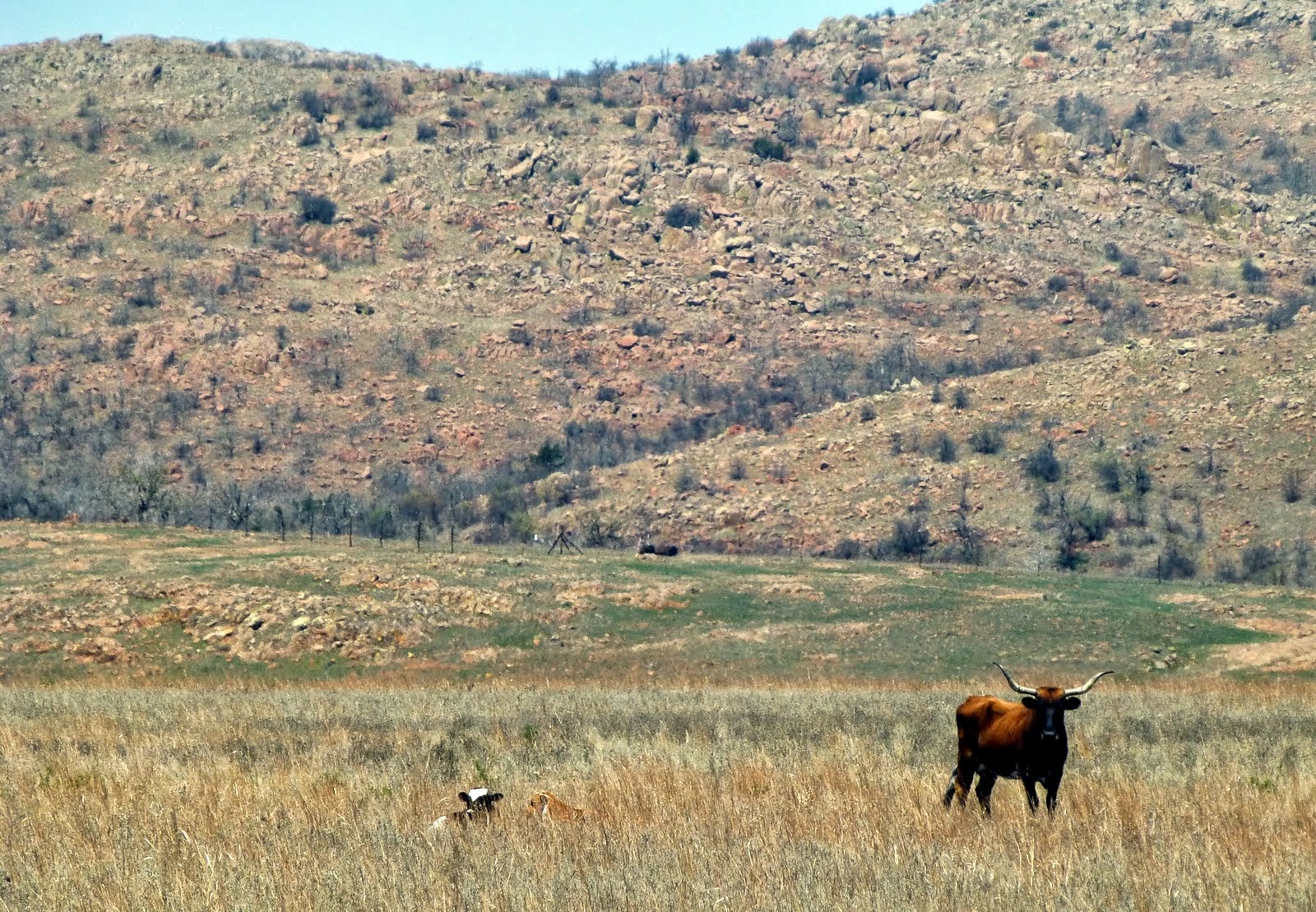
Texas longhorn cattle were next and returned to the refuge in the mid 1920s. They never were wild but, so many longhorns had been breed to mix the longhorns with better "meat" cattle so few pure breeds remained. Congress set aside funds to start the herd. Imagine that NOW! The herd is about 300 strong.
There are other animals of the plains here; prairie dogs for one. Scurrying all over their towns.
The refuge has also done significant work to bring the black capped vireo to a more stable population (from endangered).
The Refuge is beautiful -- craggy granite peaks, vast prairie grasslands, many small creeks and lakes. Herds of animals just wandering around -- and on the weekends: lots of folks having fun! We are too early for the spring wildflowers (yikes there is a frost warning up!!!) so maybe down the road I will see the prairie in bloom.
East -- blink that was Texas.
East -- um, I guess we are in Oklahoma. Um.
Our destination was the Wichita Mountains Wildlife Refuge -- a truly unique spot among the nation's wildlife refuges. Established in 1901 as a Forest Reserve, the purpose was to set aside "the mountains" from the area being opened for settlement in a land auction. In 1905, the area was re-designated as a Forest and Game Preserve--and the game of the day: bison!
Like in OOPS -- the bison is about extinct, so let's move a few from the Bronx Zoo (to great hooplah) and see if bison can live in a controlled "wild" setting. It worked and today the herd is maintained at about 650 head. Bison are culled each year and auctioned.
Well, once the bison were established it was decided to try bringing back the elk. The first elk were brought in from the Jackson Hole area, apparently the local elk were truly extinct. The herd here now is about 700 strong. Elk are hunted via a special lottery each year.
Texas longhorn cattle were next and returned to the refuge in the mid 1920s. They never were wild but, so many longhorns had been breed to mix the longhorns with better "meat" cattle so few pure breeds remained. Congress set aside funds to start the herd. Imagine that NOW! The herd is about 300 strong.
There are other animals of the plains here; prairie dogs for one. Scurrying all over their towns.
The refuge has also done significant work to bring the black capped vireo to a more stable population (from endangered).
The Refuge is beautiful -- craggy granite peaks, vast prairie grasslands, many small creeks and lakes. Herds of animals just wandering around -- and on the weekends: lots of folks having fun! We are too early for the spring wildflowers (yikes there is a frost warning up!!!) so maybe down the road I will see the prairie in bloom.
 |
| Walking the trails of the Refuge |
 |
| Hello -- and please keep on riding that bike of yours! |
 |
| Home is where I sit down! |
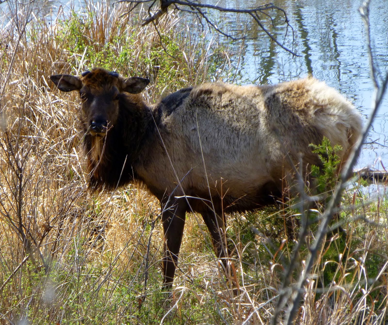 |
| Scruffy elk -- saw very few of them |
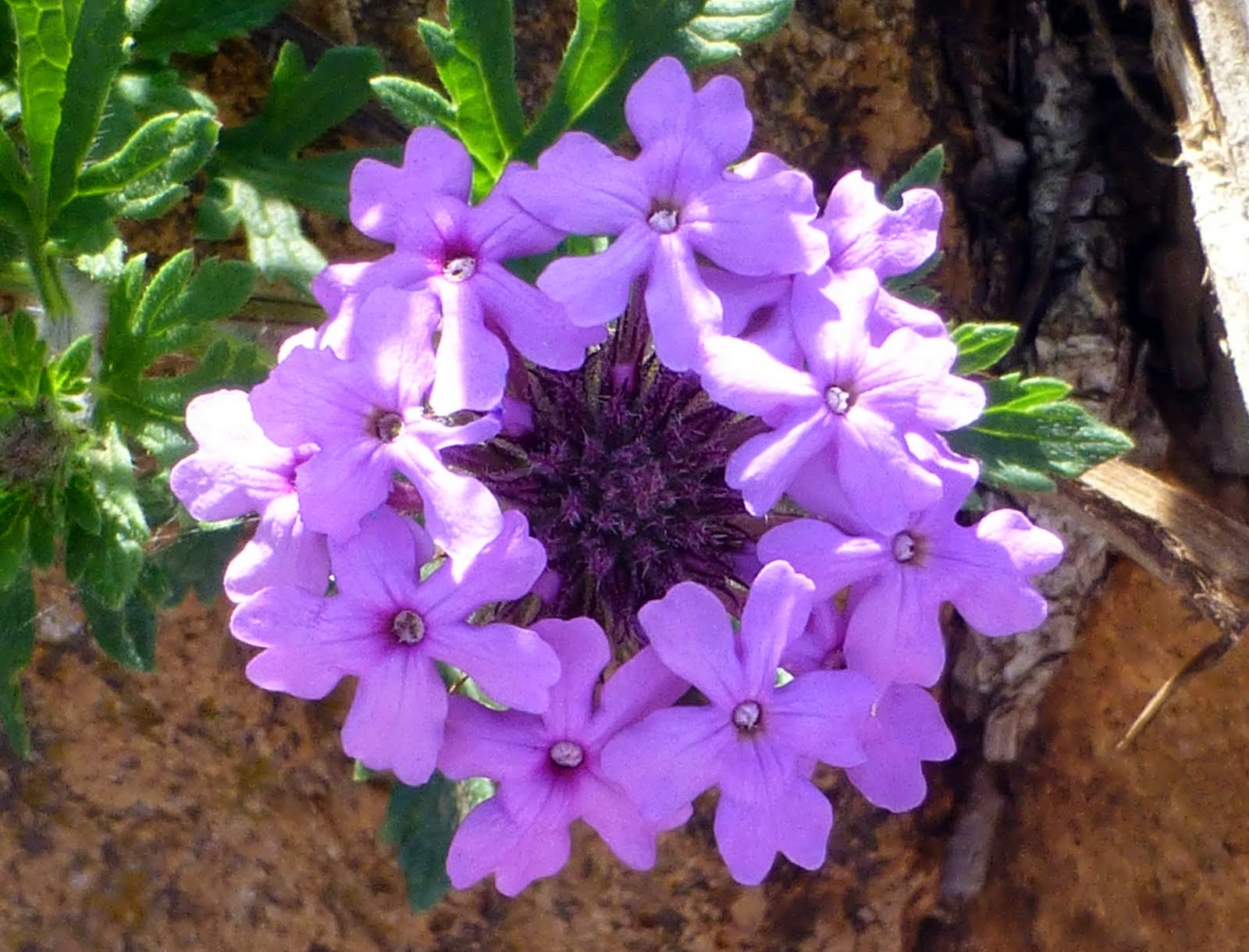 |
| Early flower |
 |
| Blue star...I think |
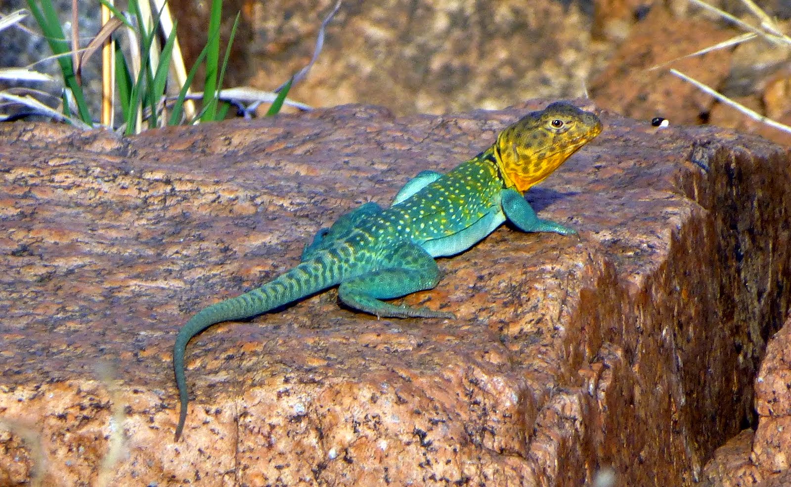 |
| Rocking Lizard! |
 |
| Charons Gardon Wilderness area -- favorite spot for bouldering & getting lost! |
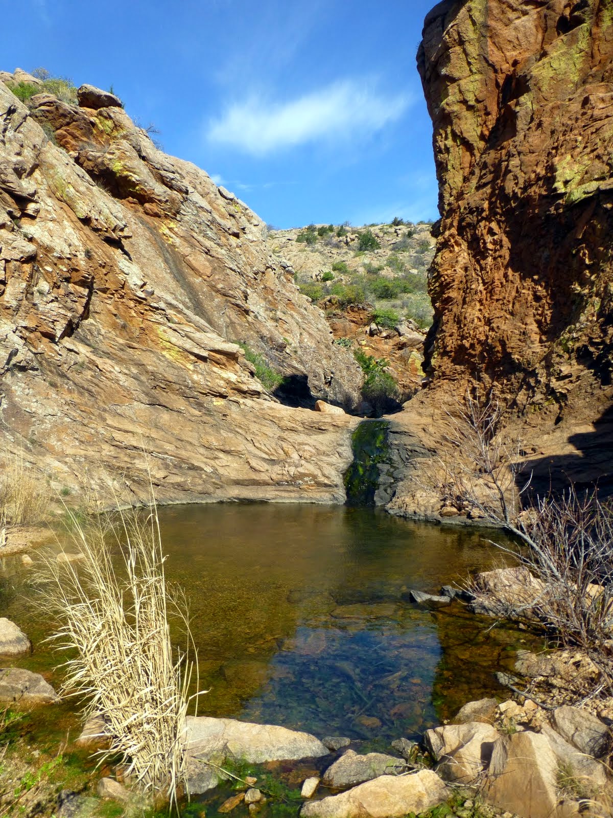 |
| Secret pool |
Wednesday, April 9, 2014
Rocks and Pots
EAST -- the direction of the season for now. EAST.
We stopped at Homolovi State Park, a couple of hours east of Flagstaff. The Park is a joint venture with the Hopis and State of Arizona to essentially protect a vast swath of Hopi lands along an ancestral trail. Not much to see as far as "rebuilt" examples, but it was amazing to see the variety and amount of pottery fragments and colorful rocks and worked points that littered the ground.
It made us feel a bit like archeologists looking at a new site!
 |
| Yup, this is the bathroom at the state park....yup. |
 |
| 3 flags at this Park. |
 |
| At this site, over 1000 rooms were found |
 |
| Pottery shards EVERYWHERE |
 |
| View to the next pile.... |
Walnut Canyon National Monument
Walnut Canyon, just a bit east of Flagstaff, was a "temporary home" to ancestral Hopi peoples. The Canyon was occupied for only a hundred years or so -- the peoples built tiny rooms into the walls of the Walnut Canyon. A couple of hundred people lived here & like many places was abandoned in the late 1300s. Maybe they just moved on north?
This Monument features the Island Walk -- go down a 150+ feet via 200+ steps and then walk around "the island" of homes/dwellings. Way amazing!!
This Monument features the Island Walk -- go down a 150+ feet via 200+ steps and then walk around "the island" of homes/dwellings. Way amazing!!
 |
| We had an early start from Cottonwood -- I opened the blinds and WOW! a balloon headed my way! Part of the Sedona tourism program. But so lovely! |
 |
| The Rim above Walnut Canyon is about 7000 feet -- so quite cold and harsh in winter. The water in the creek below was seasonal--definitely worth the name Sinagua Peoples! Make pots and stow water all year round?? |
 |
| Fine dwellings on the shady side! |
 |
| Tall folks at a disadvantage! |
 |
| Tiny door |
 |
| spring |
 |
| Look for several dwellings across the way -- experienced Indians could easily climb these walls! |
 |
| Loving the color! |
Subscribe to:
Posts (Atom)