Friday, May 31, 2013

Calf Creek -- Grand Staircase Escalante National Monument

We blew out of Kodachrome and made a beeline for Calf Creek Recreation Area, part of the GSENM. The area features a small campground and a hike along the year round Calf Creek to the base of a 126 foot waterfall.

For us, it offered a quiet haven listening to the gurgling creek and chirping birds while we recovered from the dusty onslaught from Kodachrome.

The campground straddles the Calf Creek -- and to access about half the sites meant driving through the creek!  Walking back to the bathroom, one used the small suspension footbridge.  I guess at times of flash floods, a few campsites can be inundated or stranded!  Welcome to life in Canyon Country.

The hike was 6 miles round trip; mostly level but actually challenging as long stretches of it were through sand.   Slog, slog, slog.  The scenery was incredible and unique with the rich riparian environment in the base of the canyon.  We were treated to wildflowers, birds, rocks, beaver ponds, trout, and evidence of Pueblo Indians rock art and cliff side granaries.  And finally:  a misty, waterfall cascading 126 feet!  

Footbridge across Calf Creek connecting 1 side of campground to the other

Flower in the campground

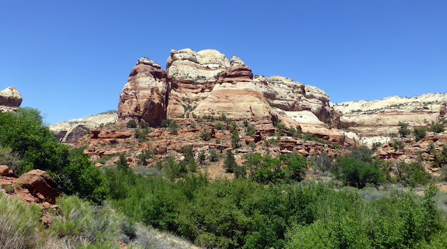
Trail along the Calf Creek -- so much green to contrast the rocks and sky

Ancient peoples rock painting

Desert Varnish

Water Fall -- year round source of water in the canyon

Let's go fishing!

Gambel's Oak Leaves -- a lovely tree in red rock country

Rocks and trees

Driving to our campsite!  

Thursday, May 30, 2013

Kodachrome State Park -- Utah

A long drive from Bryce Canyon, um, maybe 25 miles max, and we arrived at Kodachrome State Park.  This is considered one of the gem's in the state park system -- a smorgasborg of colors and shapes.   The area abuts with the Grand Staircase -- Escalante and was first explored in the late 1940s and received the nickname "Kodachrome" at that time.  Kodak liked the free publicity!

One hike took us through the Cottonwood Narrows.  It never got narrow -- but the rocks were steep and lovely; there were plenty of flowers.  We also thrilled to the haunting song of the canyon wren.  Never saw the bird; but sure heard the tune.

We also explored Grovosnor's Arch -- named for someone at the National Geographic.

And a hike around the campground and through the pipes and freestanding towers in the park.

And, however lovely the place was, the wind was howling!  And with it -- a fine coating of red dust EVERYWHERE.  Through the mesh on the tent, into our teeth, all over our food.  EVERYWHERE.

So we left....

Cottonwood Narrows

Can you hear the canyon wren?

Flower

Flower

Flower

Rock View

Flower

Driving through the Escalante

Rattle, rattle down the road

See the arch?

Close up of the arch

Campground is between the red and white cliffs

Amazing rocks.  

Monday, May 27, 2013

HooDoo Magic: Bryce Canyon National Park

The hoodoos of Bryce Canyon National Park cast a memorable spell and drew us in for days of hiking, birding, nature study, and exploration.  The exquisite detail and melding colors of the hoodoos along the trail kept us walking:  what would be around the next bend?

And around the next bend:  more hoodoos, colors anew, birds (including a peregrine falcon swooshing by), vistas, and wildflowers.  Yeh, a lot of tourists on the main trails but a bit off the beaten path we found our own world.

Bryce is certainly a mecca for international tourists.  In fact, in a first for us, we had a National Park Volunteer from Germany giving the Geology Talk!  (He also gives the talk in German.)  At the Visitor Center, 2 of the 3 rangers/volunteers were speaking German to tourists!!

Bryce Canyon.  Based on the Geology -- maybe it should be Bryce Eroding Cliff Edge National Park!

Looking East

The Paiutes think of the hoodoos as Legend People: Turned to stone by the coyote trickster!

Rocks and Sky and Trail

One of many blooms on a 4 foot stalk

A variety of Indian Paintbrush found only in Bryce -- lovely muave to contrast the sandstone.

Tiny flowers struggle to gain a root hold in the rocky soil

More hoodoos -- we were treated to watching a full moon come up over hoodoo country.

Look UP to see the rocks

Look out to see the rocks.  Look at the rocks!

Wednesday, May 22, 2013

Dixie National Forest

Dixie National Forest straddles the divide between the Great Basin and the Colorado River in southern Utah.  Scenery ranges from desert canyon gorges of amber, rose, and sienna to high mountain forests, plateaus, and alpine lakes.  It is nearly 2 million acres in size -- with elevations from 3,000 to 11,000 feet.  The name Dixie?  Southwest Utah was called Utah's Dixie by early settlers sent to the desert to grow cotton and silk, and the name stuck.

Our first introduction to Dixie National Forest was Red Rock Canyon.  We tucked into a Forest Service Campground and immediately hit the trail.  Red Rocks.  Formations of Red Rocks.  Stunning views.  Solitude.  Oh yeah, a bit of wind.  And we broke out the down sleeping bags as we are climbing in elevation...and dropping in temperatures.

RED ROCKS everywhere

more rocks

a flower in the rock tumble of the trailside

strange red like cone on tip of tree....no idea what it is.

Shared trail -- horse, bike, and foot.  Other trails include for ATVs.

Looking at signs of erosion

Grand Staircase Escalante National Monument (GSENM)

Back to Utah...and where to go?  Let's try the Grand Staircase Escalante National Monument (GSENM) -- a vast expanse of nearly 1.9 million acres of high, rugged and remote plateaus with bold and multi-hued cliffs.  Everything but people and paved roads and services.  So...we set out to do "dispersed camping".  The rules are simple:  don't drive off pre-existing gravel or rock roads, camp in existing disturbed areas, and leave no trace (pack it in, pack it out).  Sort of like back packing but a whole lot easier on the legs!

We found a spot north east of Kanab, and settled in for a warmer, but still breezy night.  Then we hiked up Lick Wash before finding another spot along Timber Mountain Road.  It was great!  We plan on more time in the Monument as we move east.

Our site tucked up on one rock wall -- looking at a series of White Cliffs

Grazing on the Land....a bit of a traffic stand off

Lick Wash...rocks and sky.  Thankfully no water (like in flash floods)

Textured & Colored Rocks everywhere

A Bit More of Zion...

We had one more afternoon in Zion:  overcast and even a few drizzles.  Our hike to Hidden Canyon afforded more stunning vistas and soaring condors.  The next morning we drove south to the North Rim of the Grand Canyon through the Zion Mt Carmel tunnel.

WOW, we loved Zion.  At this point, it is a close second to Yosemite in "our favorite NP" game.

Flower.  

Raven

The Stair Master:  Zion Canyon Style

Into Hidden Canyon

Trail Along the Ledge of Sandstone...not for the queasy

A surprise arch in the canyon

Early Morning view of the Watchman

Checkerboard Mesa in the eastern portion of Zion